Blue Hill Section 1000

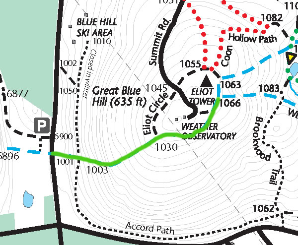
Accord Path

Base Path Connector
Assessment (2016)
Adopted by Tim Farmer

Brookwood Road

Chestnut Run Path
Assessment (2016)
Adopted by Tim Farmer

Cliff Trail (FBH)

Dalton Path

Eustis Trail
Assessment (2016)
Adopted by Tim Finocchio

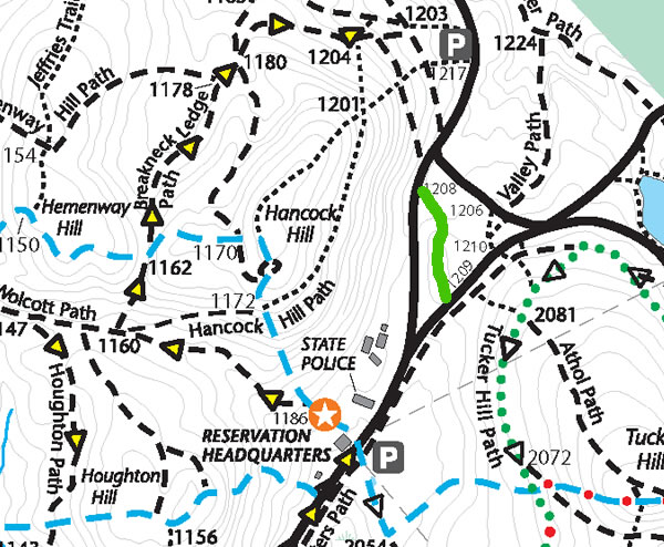
Hancock Hill Path

Houghton Hill Path
Assessment (2016)
Adopted by Mimi Kugler

Jeffries Trail
Assessment (2016)
Adopted by Tim Finocchio

Puddle Path

Skyline Trail North
Assessment (2016)
Adopted by John O’Neill

Summit Road
Unquity Path (FBH)

Wolcott Path

Bartol Path

Border Path
Adopted by Dave Humphreys (1100-1135),
Michael Pratt (Unquity Road to 1135), Kira LaFosse-Baker (Home Base Learning Center) (1215 to Hillside St)
Assessment (2016)

Brookwood Trail
Assessment (2016)
Adopted by Steve Murphy

Chickadee Path (FBH)

Conference Center Trails

Eliot Circle

Five Corners Path
Assessment (2016)
Adopted by Bob Vogel

Hancock Trail

Houghton Path
Assessment (2016)
Adopted by Mike Prokosch

Massasoit Path (FBH)
Adopted by Kira LaFosse-Baker (Home Base Learning Center)
Assessment (2016)

Rotch Path
Assessment (2016)
Adopted by Dave Humphries

Skyline Trail South
Adopted by Earl Fay (Rt. 138 to 1066 Eliot Tower), Bob Flagg (1066 Eliot Tower to Hillside St.)
Assessment (2016)

Summit Trail

Valley Path
Adopted by Kira LaFosse-Baker (Home Base Learning Center)
Assessment (2016)

Base Path
Assessment (2016)
Adopted by Tim Farmer

Breakneck Ledge Path
Assessment (2016)
Adopted by Mimi Kugler

Carberry Path

Circle Trail

Coon Hollow Path
Assessment (2016)
Adopted by Jim Green

Eliot Path (FBH)

Half Way Path
Assessment (2016)
Adopted by Anna MacDougall

Hemenway Hill Path
Assessment (2016)
Adopted by Mike Prokosch

Houghton Trail
Assessment (2016)
Adopted by Mimi Kugler

Pipsissewa Path (FBH)

Samoset Path (FBH)
Skyline Trail West
Assessment (2016)
Adopted by Earl Fay

Trailside Path (FBH)

Wildcat Notch Path
Assessment (2016)
Adopted by Will Corrdin