For the on-line version, click here.
Public considers future uses for Indian Line Farm,
former airport siteBy Jay Turner, Citizen Staff
former airport siteBy Jay Turner, Citizen Staff
Defenders and promoters of the need for more open space in the town of Canton may one day be rewarded with a pair of natural treasures, as recent public discussion on two DCR-owned sites, both with a history of contamination, has focused almost exclusively on conservation and restoration.
On back-to-back Thursdays over the past two weeks, separate meetings were held to discuss possible future uses for both the Indian Line Farm property on Washington Street (Route 138) and the site of the former Canton Airport on Neponset Street. And while it might take years before the potential of either site is realized, attendees at both meetings, which included interested citizens as well as state and local officials, seemed to be united in their desire to preserve the land as public parkland and open space.
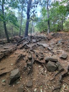
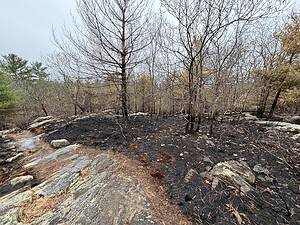
In both cases, prior industrial uses had left behind high concentrations of Polychlorinated biphenyls (PCBs) — a toxic carcinogen — in the soil, prompting state and federal environmental agencies to initiate cleanup efforts. At Indian Line Farm, which at one point was declared a Superfund site by the Environmental Protection Agency, removal of hazardous waste drums and thousands of tons of contaminated soil began in the early 1990s and was officially completed in 2006.
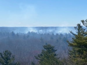
As for the airport site, PCBs and heavy metals were found at the 5.7-acre hangar area in 2001 and remain there to this day, although a decontamination project is currently in the planning stages and is being paid for with state funds secured by Representative Bill Galvin and Senator Brian Joyce. The two lawmakers were also the ones who scheduled the March 26 meeting in the Ponkapoag Golf Course function room, where citizens were encouraged to share their ideas about the future of the 328-acre site.
Among those in attendance was Canton Selectman Bob Burr, who, in speaking for the board, made it clear to DCR officials that the town was no longer in need of additional playing fields — a use that selectmen had also previously suggested for Indian Line Farm.
Burr said the town has gained several new fields in recent years, including two soccer fields on Route 138 and a baseball field at the Kennedy school.
Burr said the town has gained several new fields in recent years, including two soccer fields on Route 138 and a baseball field at the Kennedy school.
“From a [playing] field perspective, I think the town is in good shape,” he said. “Our inventory for fields has been greatly satisfied.”
Burr said he felt it was important to relay the message to state officials because Joyce had looked into the possibility of constructing fields at the airport site on Canton’s behalf, and he did not want the DCR to continue to pursue the idea unnecessarily.
Regarding the Indian Line Farm property, Burr said he personally will withhold making any suggestions until selectmen decide what to do with the adjacent Ponkapoag Golf Course, which the DCR has offered to lease to the town for 25 years.
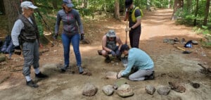
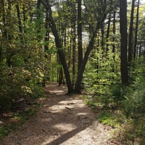
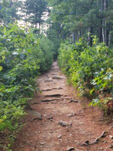
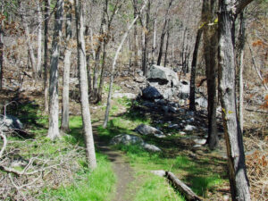
Now that it has been cleaned of contaminants, however, the 44-acre site that was once home to a dairy farm, a roadside diner and an electronics manufacturing business has begun to attract substantial interest from neighbors and conservation groups, including the Friends of the Blue Hills, who hosted the recent meeting on April 2.
According to Friends Executive Director Judy Lehrer Jacobs, although the meeting was not officially sanctioned by the DCR, the group has maintained regular contact with the state agency and at least one DCR official attended Thursday night, as did approximately 50 people, including Selectman Avril Elkort.
“It was a great event,” noted Lehrer Jacobs, who hoped the meeting would serve as a “starting point” for additional house parties and steering committees.
“The idea is to get people to think about [the farm],” she said, “and to think of it as a valuable resource to the community.”
The Friends have proposed several uses for the property, including creating bicycle or walking trails, installing informational signposts, and even making it a “natural farming extension of Brookwood Farms and its community-supported gardening efforts at the Bradley Estate.”
Lehrer Jacobs said DCR officials are in “listening mode at this point,” but she is hopeful they will consider the many community-generated ideas when they develop their master plan for the site.
At the same time, the Friends fearfully see Indian Line Farm, with its ideal location next to routes 138 and 128 and its flat, open ground, as a “developer’s dream,” and they are quick to point out that a Canton-based firm recently had the site on its radar until opting for a more feasible location in April of last year.
According to their website, the Friends are hoping to develop a vision for the farm that “does not include office buildings and parking lots.”
“In this way,” the website continues, “we hope to avert future threats to develop the property, allowing it to remain available to the public as part of the priceless recreational resource that is the Blue Hills Reservation.”
Interesting facts about Indian Line Farm
-
The name of the property comes from being the northern border of Ponkapoag Plantation, a 6,000-acre land grant given to the Ponkapoag Indian tribe in 1657.
-
The farm was purchased in the 1940s by Tobe Deutschmann, an entrepreneur and inventor and a founder of the Radio Shack electronics chain. Deutschmann ran a locally-famous roadside diner known for its neon Indian Line Farm sign, and he also held horse shows and grew and sold corn. According to the Friends of the Blue Hills, “Deutschmann’s on-site experimentation in the barns with electronics led to chemical contamination of parts of the site.”
-
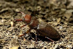
Deutschmann attempted various times in the 1950s to develop the land into a shopping mall, but each time the rezoning effort was defeated at town meeting.According to the EPA, along the 15-mile downstream pathway where runoff from the farm flows south along Washington Street and southeast toward Ponkapoag Pond, there are four Federal-endangered species habitats and 16 State-endangered species habitats.
Sources: Friends of the Blue Hills, U.S. Environmental Protection Agency
Interesting facts about Canton Airport
From Abandoned and Little-Known Airfields by Paul Freeman
From Abandoned and Little-Known Airfields by Paul Freeman
-
The airport was constructed in the early 1930s with four gravel runways and became known as the Boston Metropolitan Airport. American Airways constructed a hangar and an administration building on the property along with E.W. Wiggins Airways.
-
The famed aviator Charles Lindbergh once visited the airport, and the German airship Hindenburg conducted practice approaches there before its destruction in New Jersey in 1937.
-
During the depression years, the airport failed to grow as expected, but air shows and other demonstrations drew large crowds; during World War II, the airport was part of the defense system and flight training program along the East Coast.
-
The last aircraft-related company at Canton Airport was Helio Aircraft Corporation, led by Otto Koppen of MIT and Dr. Lynn Bollinger of Harvard, who developed the first Helioplane experimental prototype, a short takeoff and landing light aircraft. Helio’s first plane manufactured in Canton went into the Smithsonian Institute in Washington in 1963.
-
The airport closed sometime in the late 1950s and was later used as an automobile junkyard from approximately 1970 to 1980.
-
The Canton Airport property is located east of the intersection of I-95 and Neponset Street, and sits only a mile directly under the final approach path to Norwood Airport’s Runway 35.
Excerpts from Canton Comes of Age, Chapter 1
“The opening of the Canton Airport was a boon to the Junction. The neighbors often went there on Sundays to take advantage of the dollar flight and to see Canton from the air.”
“Then there were the legendary White sisters, whose house overlooked the airport and who invited friends to fly with them in a cabin plane to Plymouth and return for tea at their home. The charming sisters were frequent visitors at the airport. Known for their sense and sensitivity, they were a fixture at town meetings and often questioned the financial feasibility of proposals and theeffect change would make on the town.”
April 9, 2009