
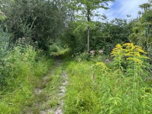
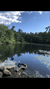
The Blue Hills is a wonderful treasure so close to Boston with miles of trails to explore and amazing views to enjoy. Whether you’re hiking the steep Skyline Trail, walking gentle paths, biking Buck Hill or just taking your dog for a stroll, you will enjoy the park more if you keep in mind these three tips. And if you want to learn more about the Blue Hills, just download the free Blue Hills Guide.
A Map: don’t leave home without it… or at least get one once you’re here!
The Blue Hills is really big – the size of 7,000 football fields. And there are a lot of trails – over 125 miles. It is easy to get off the trail you want to be following. So before you hit the trails, stop by the Blue Hills Trailside Museum (1904 Canton Ave, Milton) or the Blue Hills Headquarters (695 Hillside Street, Milton) and pick up a map. Maps are $3. (You pay on the honor system so you don’t have to worry if the buildings are open.)
Hike by the numbers
Now that you have your map, you’ll need to know what all those numbers are on the trails. Each number that is located on a trail intersection on the map corresponds to a number on a tree at that intersection. This is a great way to make sure you are still on the trail that you thought you were.
Plan for parking
Unfortunately, parking in the Blue Hills is pretty limited. If you’re visiting during the week, you usually will not have to worry. But the main parking lots at Houghton’s Pond (840 Hillside St., Milton) and the Trailside Museum (1904 Canton Ave., Milton) fill up pretty quickly on weekends during hot summer days or fall during leaf-peeping weekends. I’m afraid there isn’t a great solution, but you may consider coming in the morning to make sure you have a spot. You might have more luck at a different part of the park, like parking at Shea Rink (651 Willard St., Quincy) to visit St Moritz Pond or hop on the Skyline trail.
Want to learn more about the Blue Hills? Download a free Blue Hills Guide!


Bring Your mobile phone with the Google map app. If you get lost it will not show trails but will give you directions to the Main roads.
Great tip! Thanks for sharing.
I took a picture of the map. Good temp. Replacement if ya loose the map.
Great idea!
Download Maplets, ($3) then download the Blue Hills (and many, many other maps! places to hike, college campuses, cities, transit systems…) It even has a moving dot to show you where you are.
Good idea!
Looking forward to hiking!
Michael – So glad you plan on getting outside and hiking!