Chickatawbut Section 3000

Barberry Bush Spring Trail
Assessment (2016)
Adopted by Paul McPartland

Branch Path
Assessment (2016)
Adopted by Robert Quinn

Curve Path

Glover Path
Assessment (2016)
Adopted by Robert Quinn

Hemlock Bound Foot Path
Assessment (2016)
Adopted by Charlie Crosby

Lee Path

Reservoir Path (FBH)
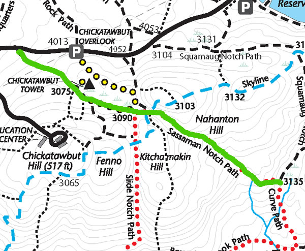
Sassaman Notch Path
Assessment (2016)
Adopted by Paul McPartland

Slide Hill Trail
Assessment (2016)
Adopted by Robert Quinn

Stokes Foot Path
Assessment (2016)
Adopted by Chris Mullin
Thayer Path (FBH)
Assessment (2016)
Adopted by Charlie Crosby

Wood Path

Bouncing Brook Path
Assessment (2016)
Adopted by Bob Flagg

Carve Path
Assessment (2016)
Adopted by Charlie Crosby

Endicott Path (FBH)

Great Dome Foot Path
Assessment (2016)
Adopted by Charlie Crosby (North of Bouncing Brook)

Hemlock Path
Assessment (2016)
Adopted by Karen Wheeler
Pakomet Path (FBH)
Assessment (2016)
Adopted by Robert Quinn
Ridge Path
Adopted by Joe Nelson
Assessment (2016)

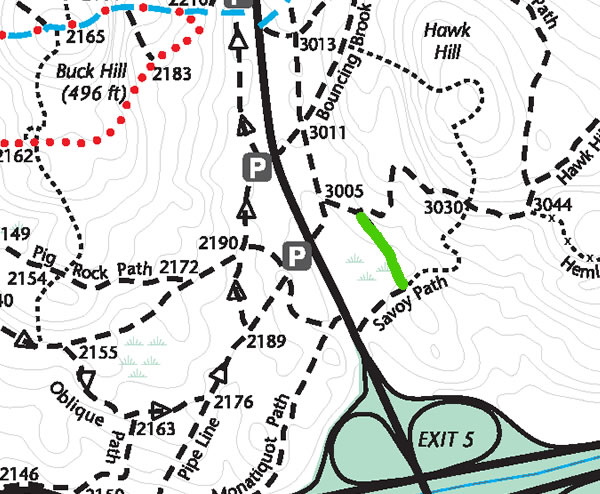
Savoy Path
Assessment (2016)
Adopted by Robert Quinn

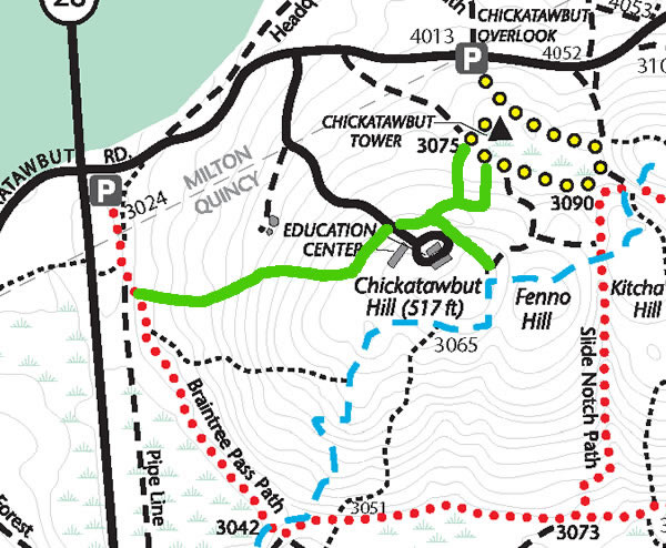
Slide Notch Path

Stowe Path
Assessment (2016)
Adopted by Charlie Crosby

Tower Path (FBH)

Braintree Pass Path

Cochato Path (FBH)

Gas Pipeline

Hawk Hill Path
Assessment (2016)
Adopted by Robert Quinn

Laurel Path
Assessment (2016)
Adopted by Karen Wheeler

Pocapawmet Path (FBH)

Romari Trail

Skyline Trail
Assessment (2016)
Adopted by Charlie Crosby

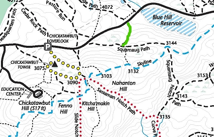
Squamaug Notch Path

Streamside Edge Path
Assessment (2016)
Adopted by Robert Quinn
